Earlier this week I decided I had to go for some long walks this weekend to enjoy the beautiful weather we’re having. I debated various choices until my Tulsa friend Carrie suggested I explore the shores of Lake Oologah, where I could meet her and her roommate Trish to see their sailboat and then have lunch in Claremore.
I first tried to walk the Skull Hollow nature trail in the Hawthorn Bluff area of the lake, but it was too overgrown. [Later I found out the overgrown portion was a trail leading to the park gazebo; the actual Skull Hollow Trailhead was farther along the road.] And the noise from the nearby power plant, which is featured in the electricity slideshow Lynne Shaw and I made back in 1995, was irksome. I wondered at how the area could be full of campers with all of that noise pollution – perhaps they boat out onto the lake to escape it? I fled the scene and drove to the south end of the lake to attempt the Will Rogers Centennial Trail to Kite Hill. But equestrians had turned the trailhead into a churned morass of mud, so that was out too.
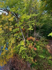
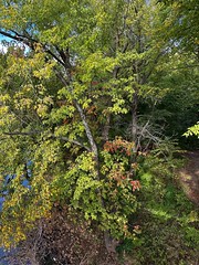
A bit discouraged, I took the county roads over to the Blue Creek Park on the lake’s eastern shore. There was no trail, but I did enjoy walking down the southern end’s quiet picnic area, where I snapped a shot of the high water inundating the trees and enjoyed watching large birds wheeling by and landing on the lake, although they were too far away for a good snapshot. Then I walked back to the car to contemplate my options, since my lunch rendezvous was still a couple of hours away.
I spotted the nearby town of Foyil on the iPhone’s map and recalled that it is the site of a highway tourist attraction, the crazy Totem Pole park built by Ed Galloway between 1937 and 1962. The strange “totem pole” is being restored by the Indian Territory Questers, who are reviving its lively colors. A Boy Scout troop had built a small nature trail in the park six years ago, and I enjoyed wandering through it although there was very little to catch the eye or the camera lens.
I zipped back to the south end of Lake Oologah to join my friends, see the sailboat, and indulge in a classic Oklahoma meal at the Hammett House in Claremore – chicken-fried chicken with mashed potatoes and gravy and a big slab of chocolate cream pie for dessert. Urp!
Bidding my friends farewell, I decided to see what I could find in Claremore. I drove by their lake, but the sunny concrete exercise trail there was not my cup of tea. So I crossed 66 and drove onto the campus of Rogers State University to see if I could find some snapshot subjects. I discovered their Conservation Education Reserve, a 120 acre outdoor classroom that is open to the public and features a number of paved trails reminiscent of Bartlesville’s Pathfinder Parkway. That’s the ticket!
I followed the path over to their wetlands area, where I saw a deer across the water, and trekked through the grassland and on through the forest until I finally arrived at their butterfly garden. I saw few butterflies, but other insects liked the prettiest flowers, and I took snapshots of red, orange and yellow, and white and yellow blooms. Yes, my mastery of plant taxonomy is quite amazing, I must agree!
It was now mid-afternoon and I was determined not to head back to Bartlesville too soon. So I meandered over to Owasso, finally happening upon the tiny “downtown” of this sprawling bedroom community where so many Bartians like to shop. I drove over to look at its Elm Creek Park, later discovering that Owasso’s original name was Elm Creek, but the park was small with little to offer. Owasso has almost doubled in population since 2000 and is now larger than Bartlesville, but it has little of interest for me.
With the afternoon fading away I decided another long walk was in order and drove to Turkey Mountain in south Tulsa. They’ve built a nice big new parking area there and will be adding a much-needed restroom facility. The mountain runs north-south with a large number of bike and hiking trails. I started out on the long yellow loop trail, walking along the low eastern edge of the mountain. My walk sped into a jog since it was getting late in the day and I wanted to get to the north end in time to shoot the view of downtown Tulsa in the evening sunlight.
I “changed lanes” a couple of times, shifting westward to higher trails, until I reached the crest and made it to the north end. The view there is okay, but marred by power lines and you really need a powerful zoom lens for a good shot. So I did the best I could with my limited pocket shooter and later cropped and “melted” the image a bit in Photoshop Elements to get a shot I could live with. I took the blue trail back south toward the parking area, coming across a few brightly colored mushrooms at one point and also snapping a nice flash image of a plant.
I made it to the car with the sun still up in the sky (and no unwanted advances from the cruisers who purportedly haunt that mountain) and happily drove downtown for a dose of the Spaghetti Warehouse. ‘Twas a nice day for early autumn, perhaps my favorite season in Oklahoma.


Pingback: Posts about Flash and Photoshop as of September 27, 2009 - Perry Multimedia Blog